Digital Documentation of heritage site in Kolar
Our project titled " In the shadows of the rocks" Shortlisted for Heritage Documentation Awards 2018 by CoA India (Top 5 entries Nationwide).
Objective
- To identify and document historically significant structures that are unrecognized by Archaeological Survey of India (ASI).
- Develop a digitally accurate drawings and details to be able to carry renovation or re-construction activities if required.
- Accurate detailing of measurements and representation of features to be able to easily interpreted.
Methodology
- Acquire data and link with respective measurements.
- Preprocess the image by orthorectification, feature identification.
- Generate and tag control points as measured.
- Stitch neighborhood images together and generate a overall feature map.
- Generate feature map or detail map within the bounded control points.
- Process the drawings into a AutoCad document.
- Random checking to ensure measurements are within tolerance.
Concept of Photogramettry borrowed from Satellite imaging.
A recent documentation of the same temple can be seen in the below video. (credits to the respective Youtube channel.)
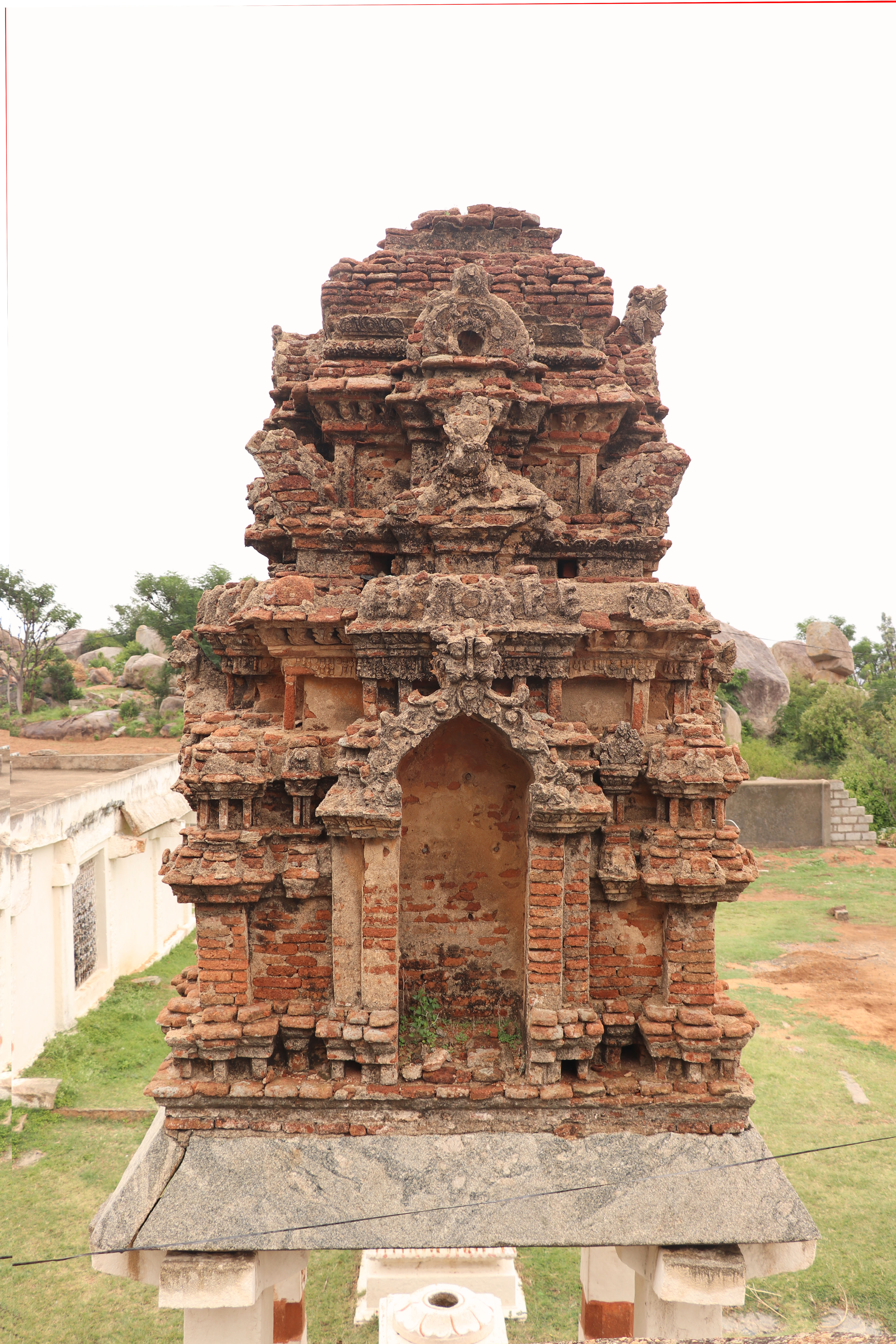
Images of the temple
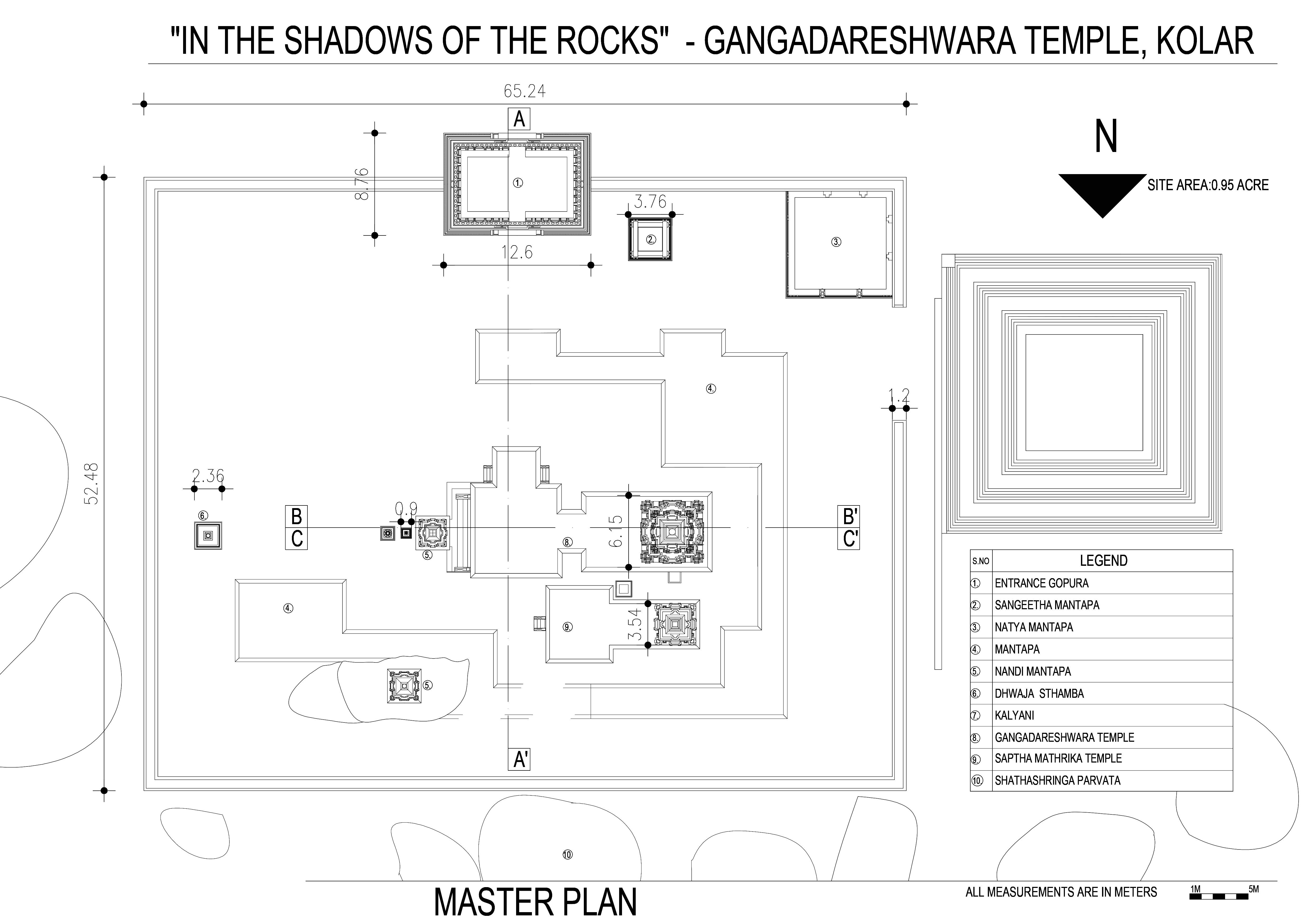
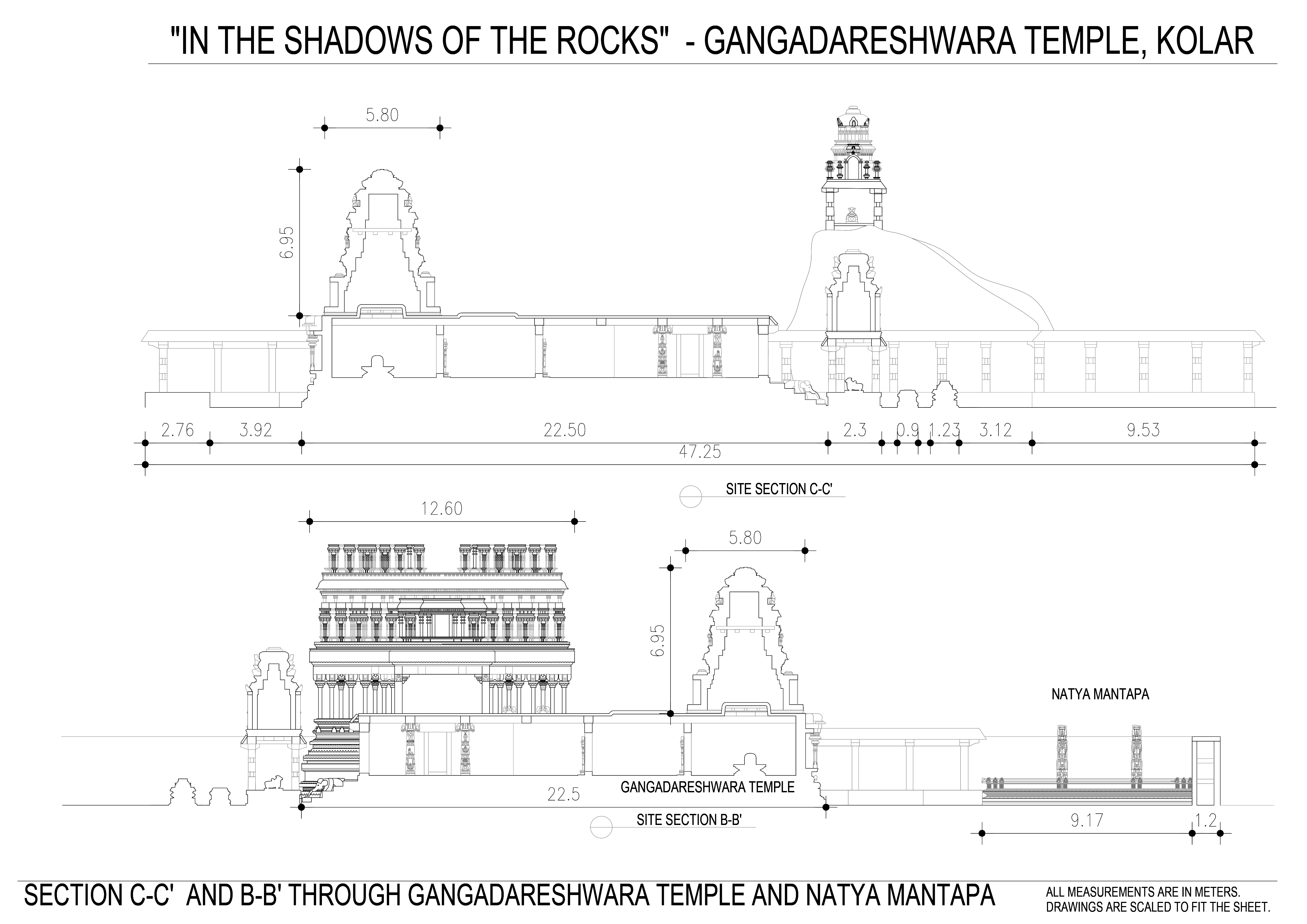
The temple nestled to the west of Kolar on top of the hill called Shatha Shrunga Parvatha or the mountain of hundred peaks in a town called Therahalli .Which was constructed by Cholas with an interesting legend which mentions that the temple was built in a day (Sunrise to sunset)
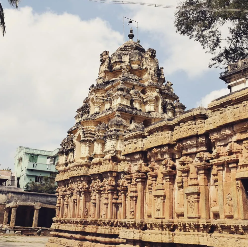
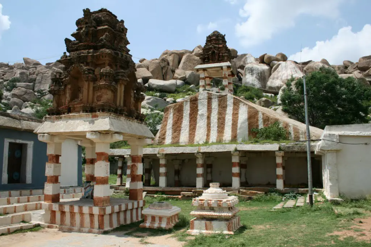
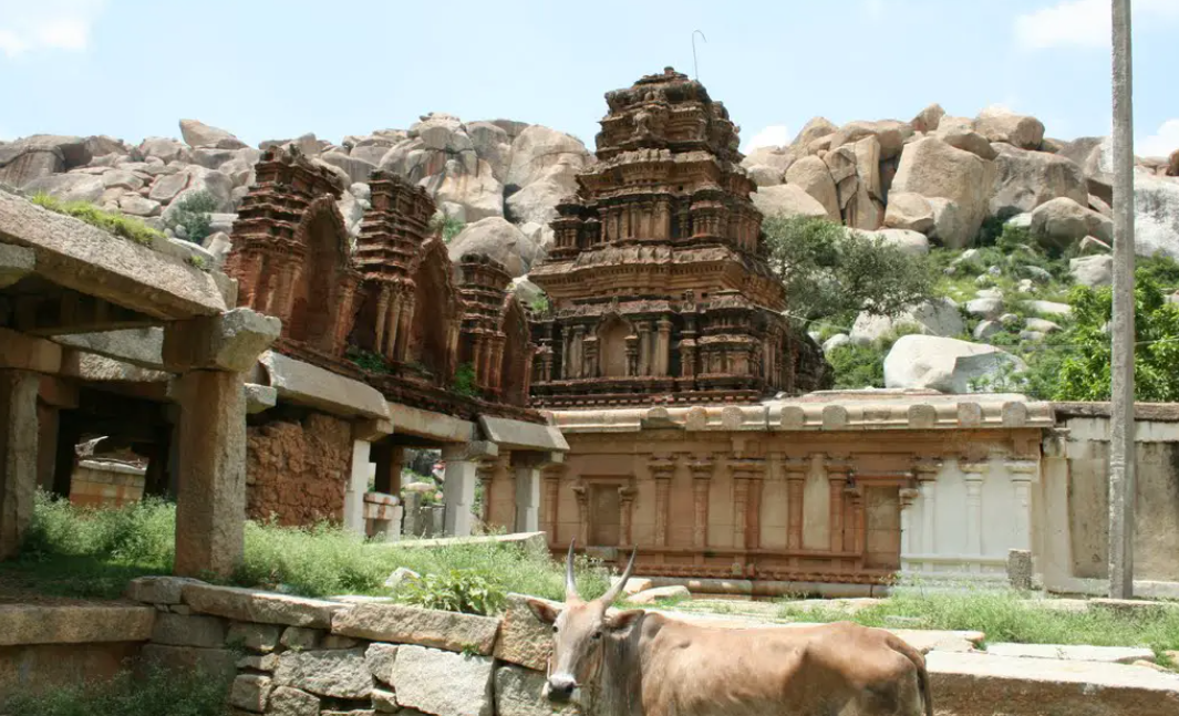
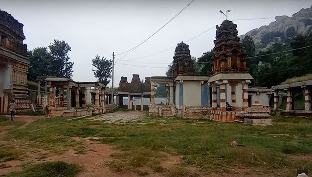
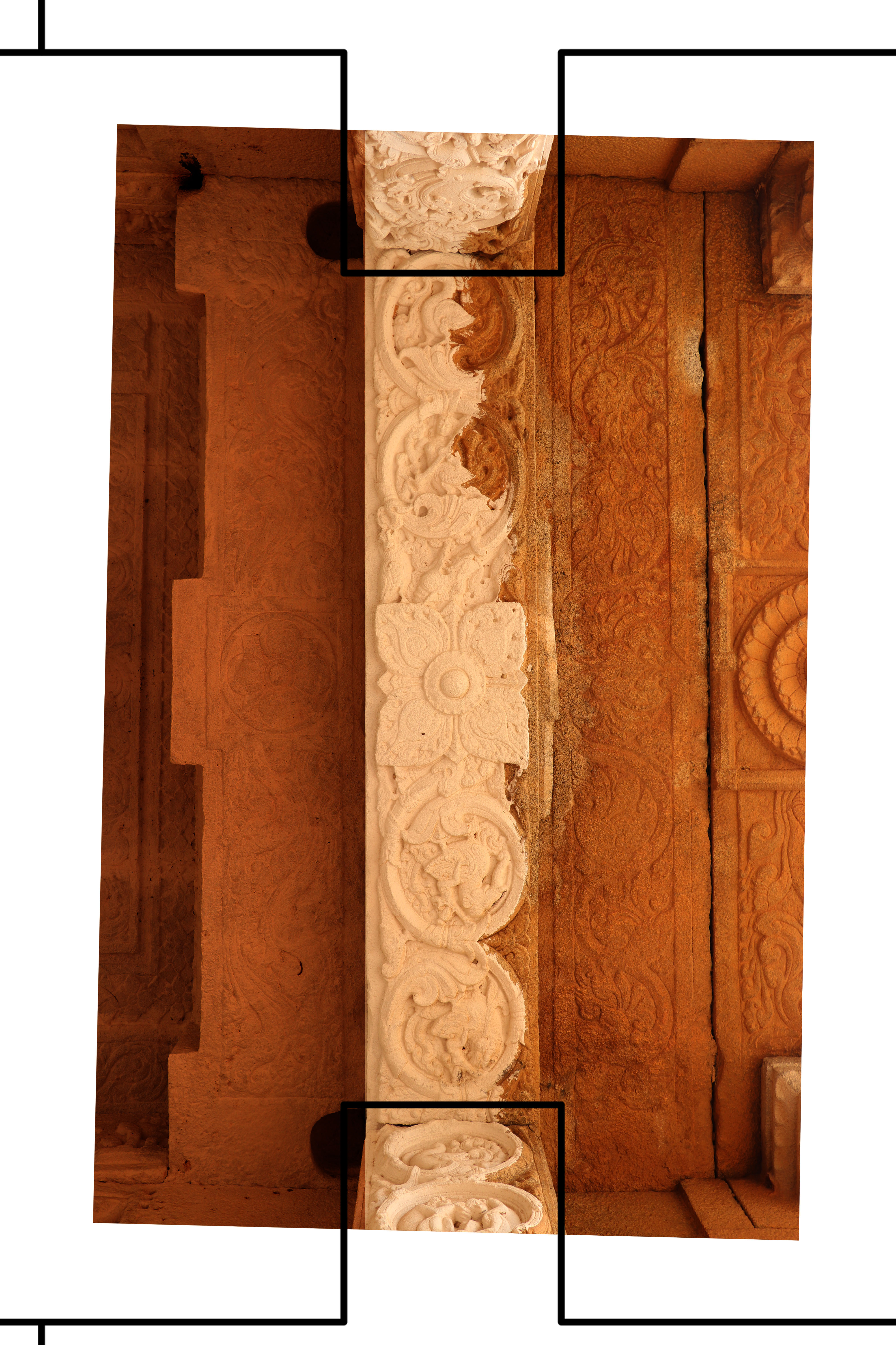
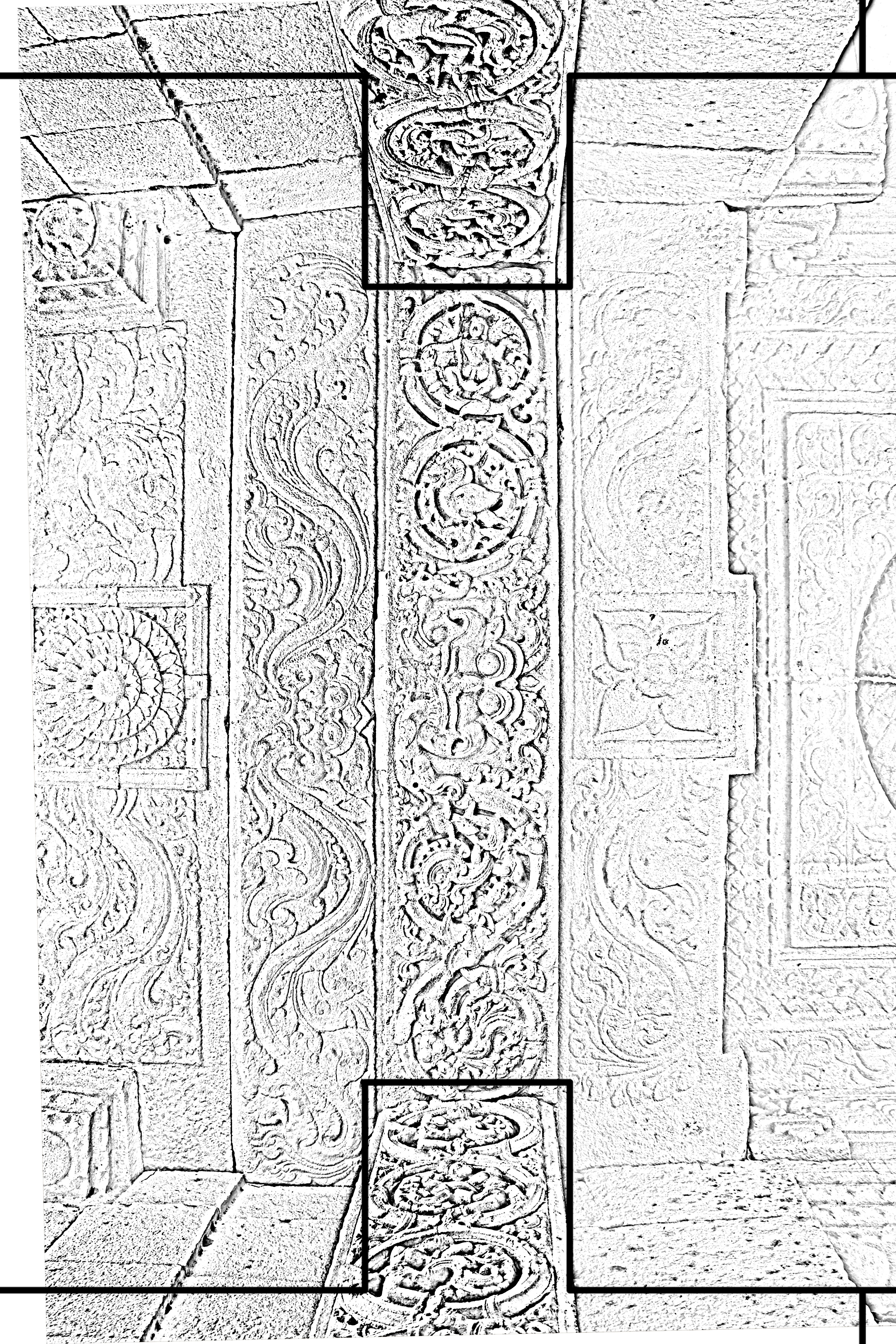
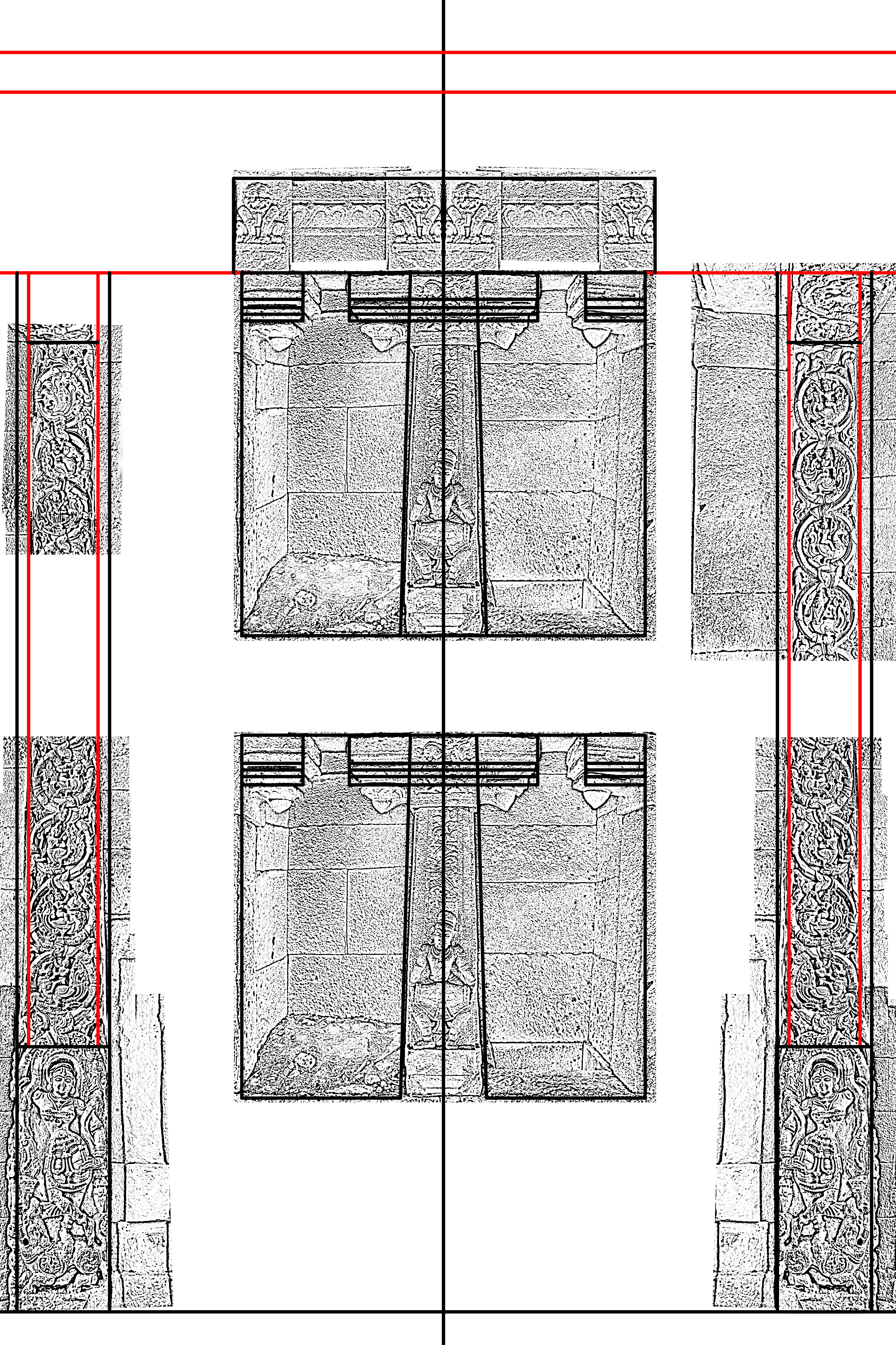
Image Preprocessing stage
Orthorectification processes were undertaken and relevant filters were used with respect to the required features to be extracted.
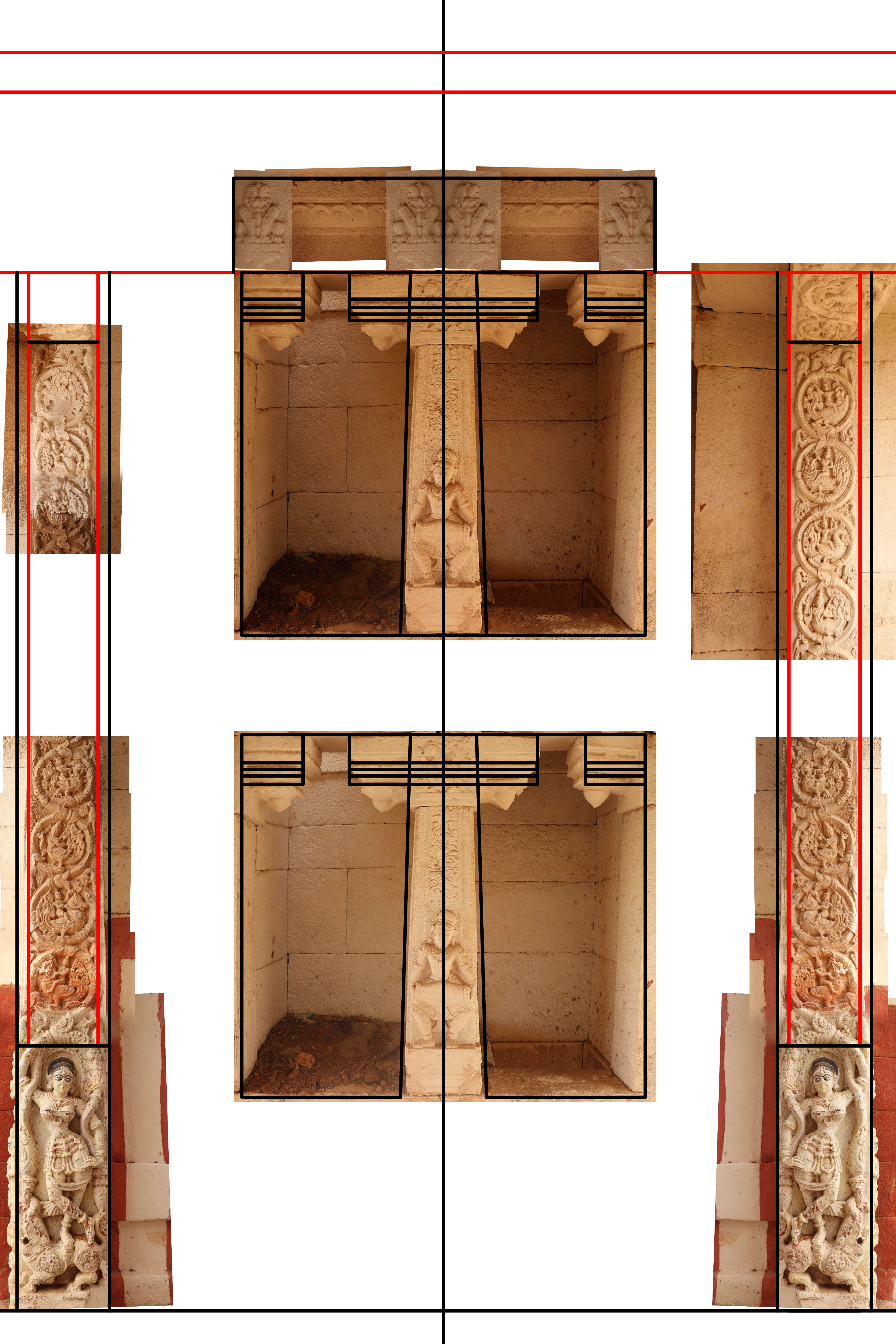
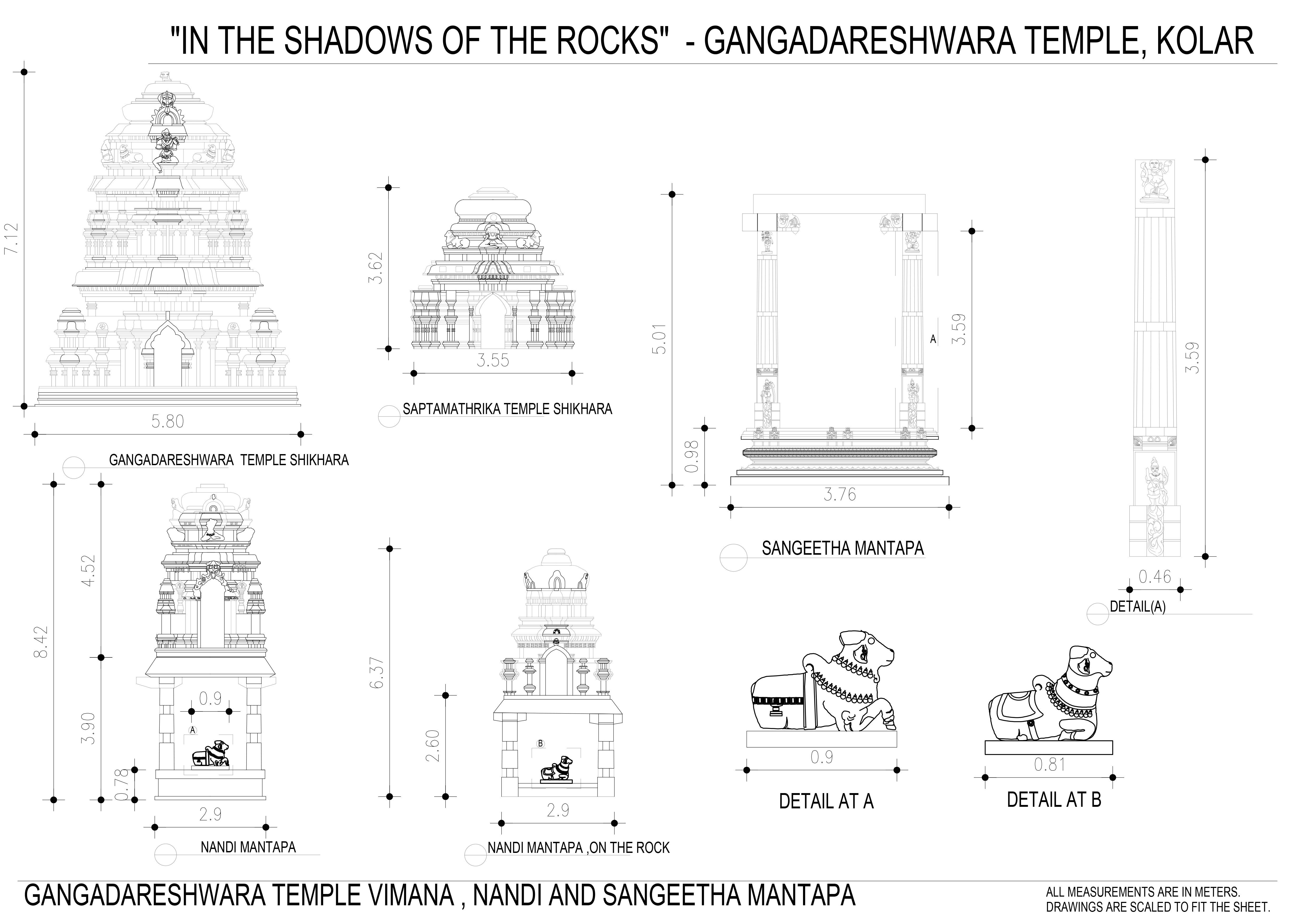
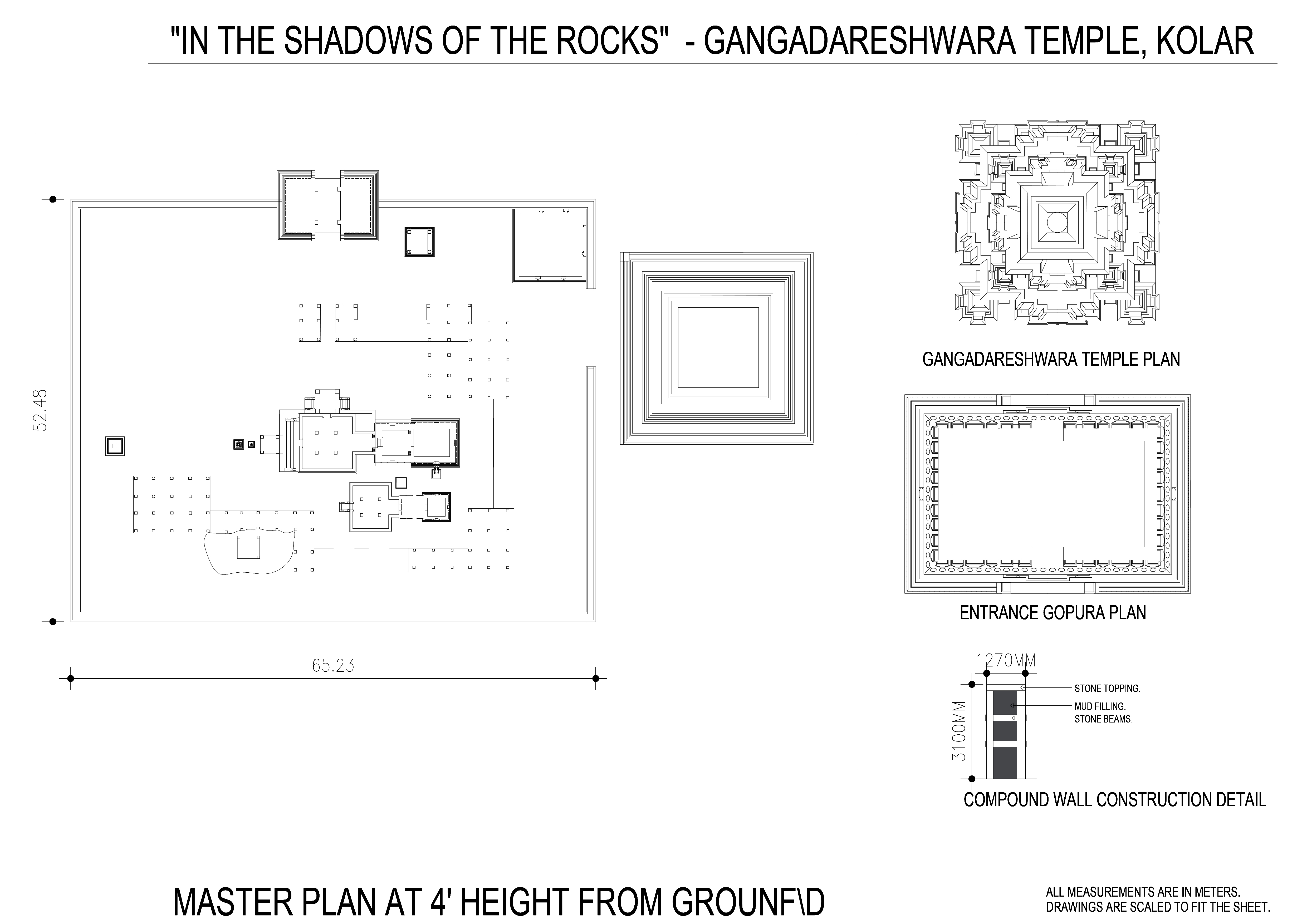
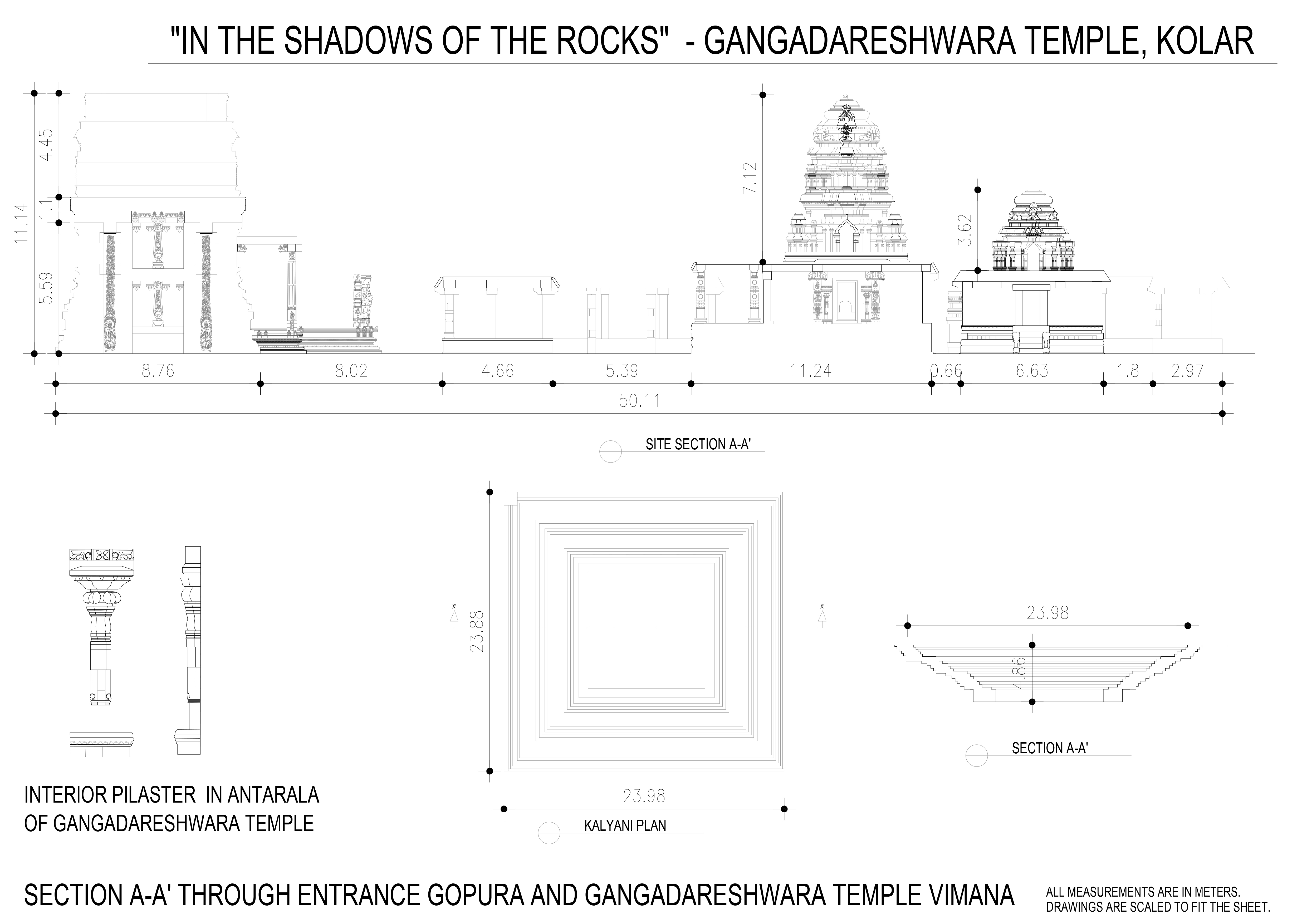
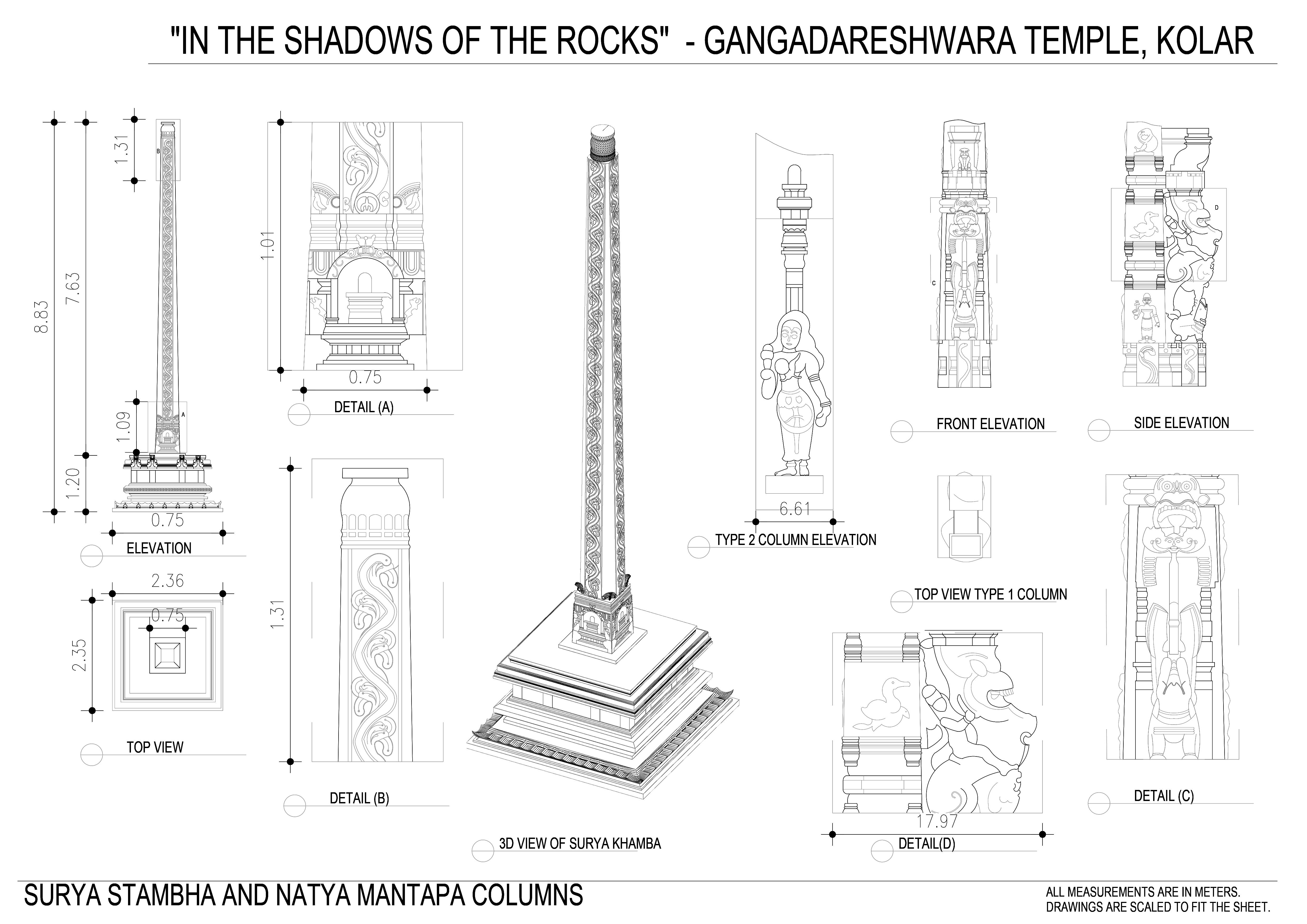
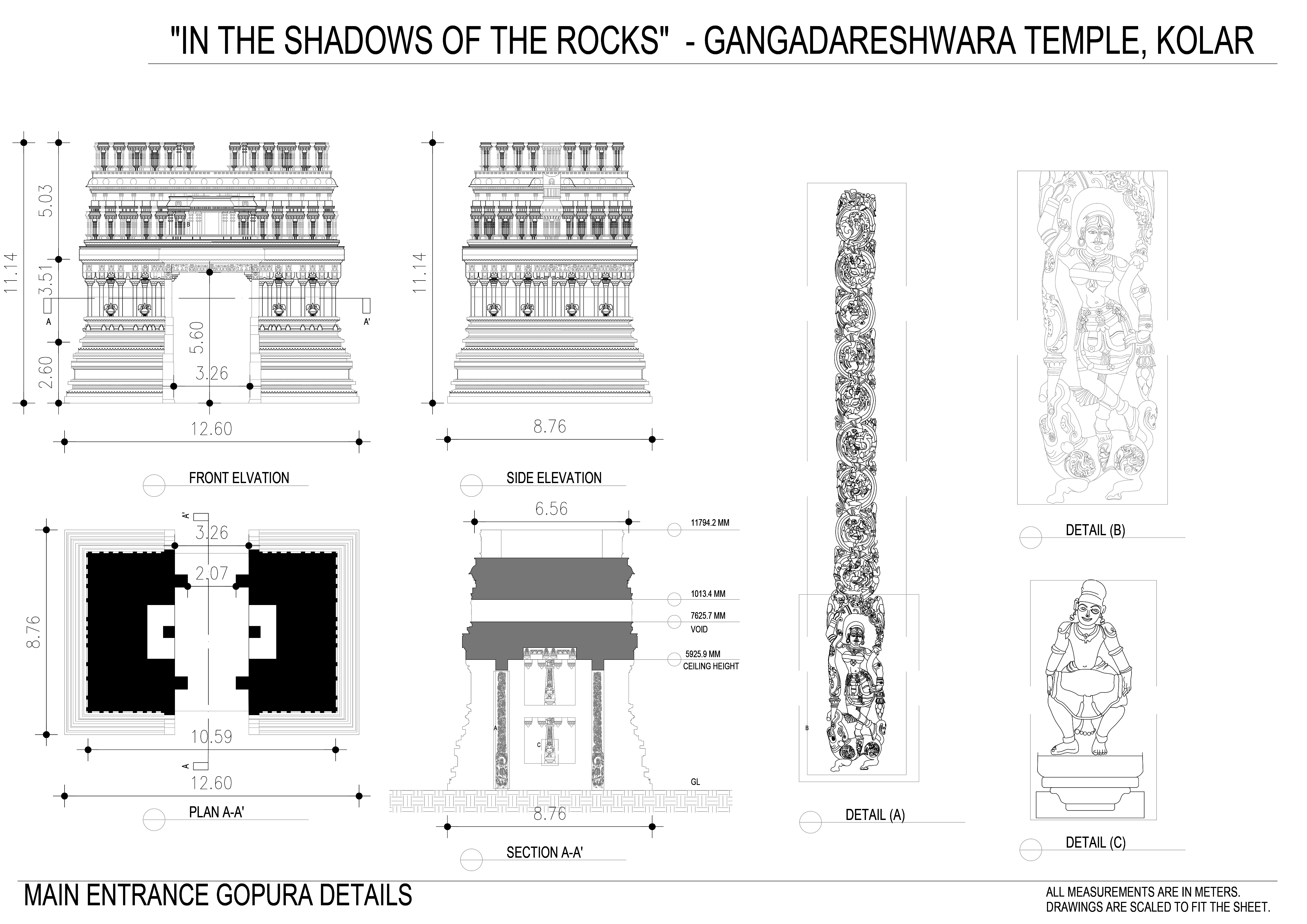
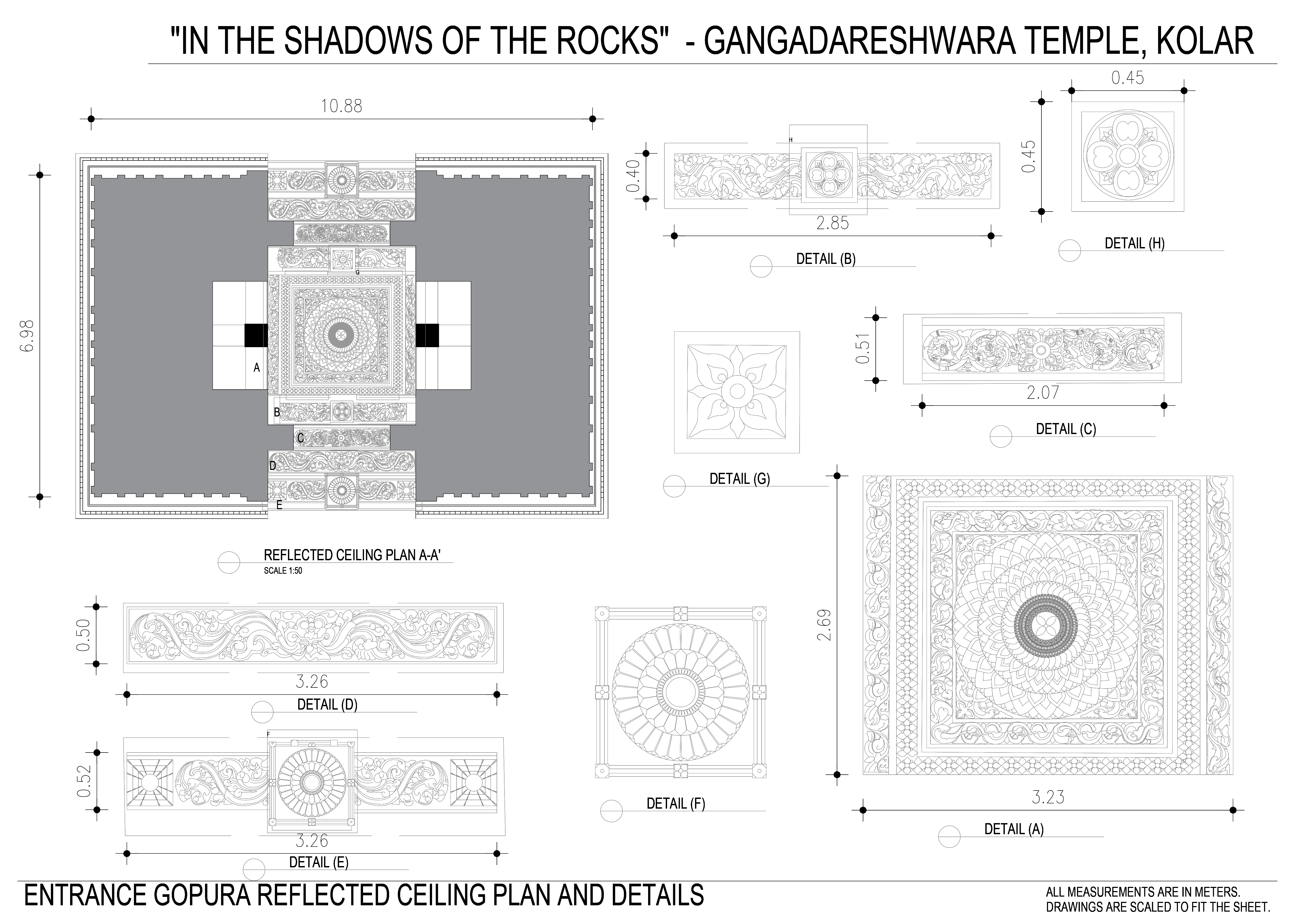
Final Documentation
Below are the final digital documention (not to scale).These drawings are available in autocad format and certain 3d models were succes generated using the below drawings with an accuracy of 10mm to 95mm.